Mount Davidson – W6/NC-423

Activation Date: 15 August 2018
Transport: Hike Distance: 0.5 miles
Elev. gain: 140 feet Time: 10-15 minutes
Rig(s): MTR-3B, VX-2R Band(s): 40m, 20m (cw), 2m, 70cm (fm)
Antenna(s): End-Fed Half-Wave
Cell Service: Excellent (T-Mobile)
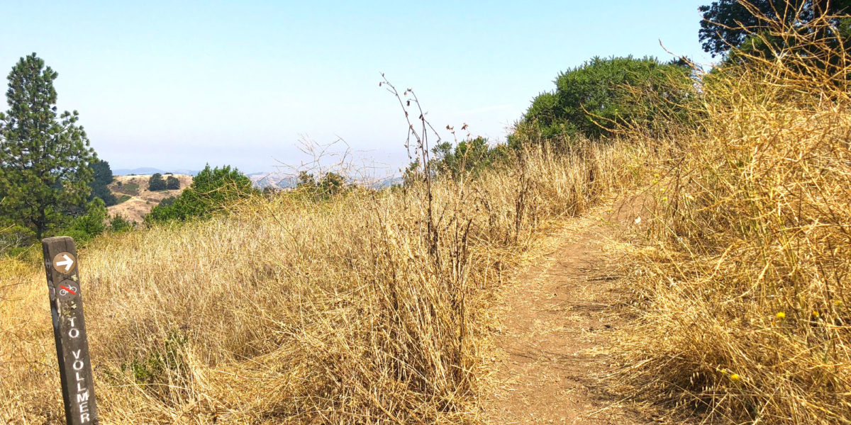
Parking: Dalewood Way
Trailhead: South Entrance
Fees/Permits: None
Route: Walk to the top
Dogs: Yes Toilet: No
Antenna Support: Lots of tall trees RF Noise: Medium

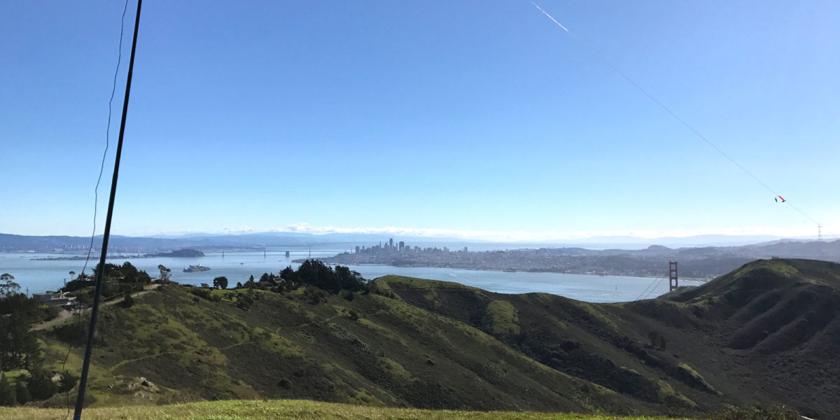
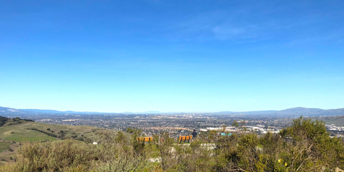
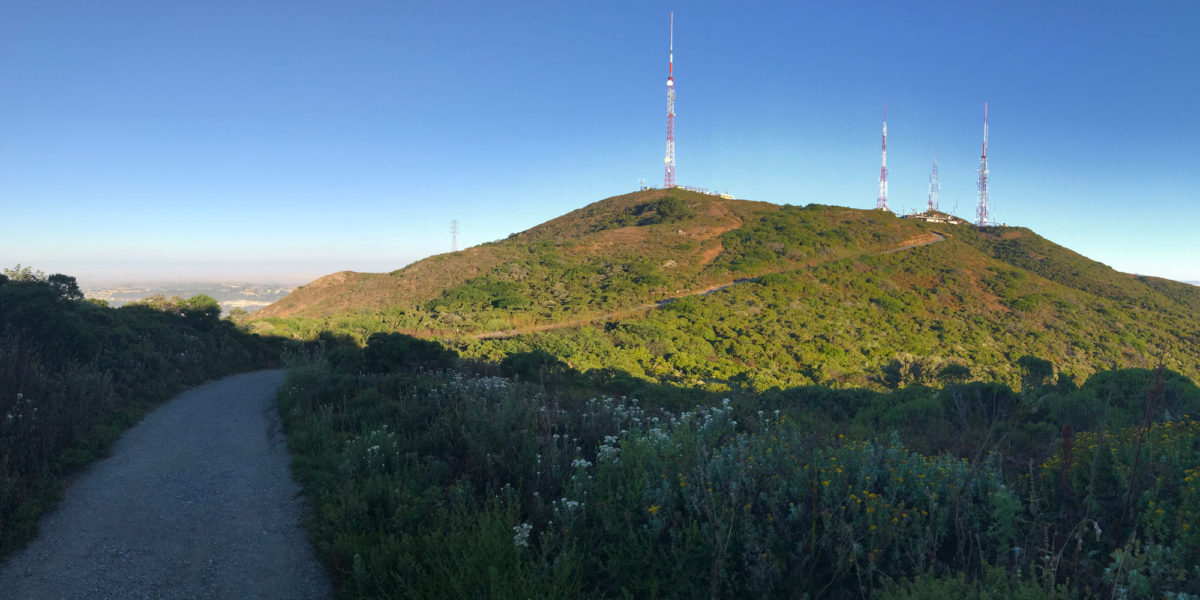
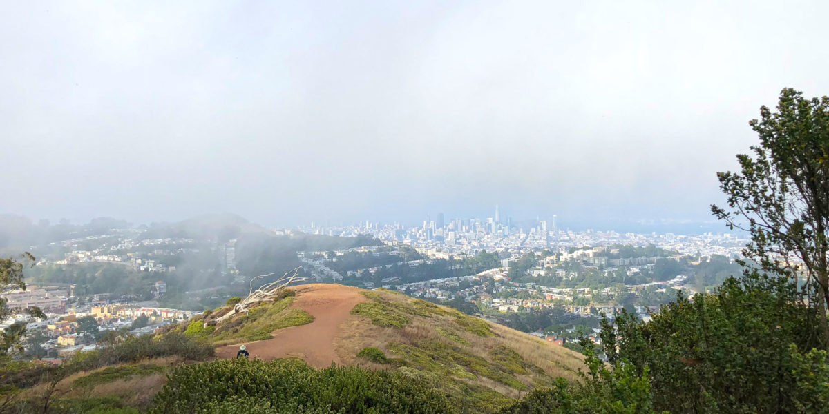
This is one of those urban summits that are great to do if you happen to be in the area. I’d driven my car up to San Francisco (I normally take the train) and decided to do a quick activation of this summit on the way back. I’d done it once before, so there was no mystery as to the length of time it’d take, or where I’d set up.

Continue reading →

Vollmer Peak – W6/NC-298 – 2018

Activation Date: 28 July 2018
Transport: Hike Distance: 1.25 miles
Elev. gain: 220ft Time: 20-25 minutes
Rig(s): VX-2R Band(s): 2m FM
Antenna(s): 12.5-inch whip
Cell Service: Strong (T-Mobile)
Parking: Seaview Trailhead
Trailhead: Vollmer Peak
Fees/Permits: None
Route: Vollmer Peak Trail
Dogs: Yes Toilet: Yes
Antenna Support: Trees
RF Noise: Moderate

After attending the Bay Area SOTA meet-up, I still had time to do a quick activation on the way home. Keeping with my clockwise trip around the Bay Area to avoid traffic and tolls, I chose Vollmer Peak. It’s a quick east-Bay summit with the parking a little over a half-mile from the top. It turned out to be a little bit of a rough activation!

Continue reading →

Richardson East Benchmark – W6/NC-407

Activation Date: 28 July 2018
Transport: Hike Distance: 1.9 miles
Elev. gain: 590 feet Time: 40 minutes
Rig(s): MTR-3B Band(s): 40m/20m (cw)
Antenna(s): QRPGuys Tri-band Vertical
Cell Service: Good (T-Mobile)
Parking: Spencer Ave Park & Ride
Trailhead: Morning Sun Trail – across the street
Fees/Permits: None
Route: Morning Sun, Alta Trails. Dirt road to summit.
Dogs: Yes Toilet: No
Antenna Support: None – bring your own RF Noise: Moderate

As you’ll see in this report, the featured photo is not from this trip. It’s from the first time I went – early last year. This year, I did this summit as a quick little activation prior to our SF Bay Area SOTA meet-up.  Jeff, AA6XA (see his blog), had the idea of starting up a quarterly meet-up for Bay Area SOTA people.  We change locations each time, since the Bay Area is pretty big, and we’d like to be able to activate different summits in the various areas.  I wasn’t sure I’d be able to do a summit after the brunch, so I picked this one to do on the way to our meeting.

Continue reading →

Briones Hills, W6/NC-371

Activation Date: 11 March 2018
Transport: Hike Distance: 4.8 miles
Elev. gain: 1600 feet Hiking Time: 2.5 hours
Rig(s): Yaesu FT-817ND, Radioddity GD-77 Band(s): 2m (fm), 30m (cw), 40/20m (ssb)
Antenna(s): QRPGuys Tri-Band Vertical
Cell Service: Acceptable (T-Mobile)
Parking: Reliez Valley Trail Head
Trailhead: Blue Oak Trail
Fees/Permits: None at this lot
Route: Blue Oak Trail, Blue Oak Shortcut, Spengler, Table Top
Dogs: Yes Toilet: No
Antenna Support: Some trees, short fence RF Noise: Low (HF & VHF)

It took me a while to write this one up! It’s been over a month since we did it. But here we go. I wanted a fun hike with my sons and the dogs, and Briones Hills seemed like just the ticket. Not too long, not too short, and with a nice bench at the top! The elevation was a little bit difficult for the boys, but everyone had a great time.

Continue reading →

Black Mountain, W6/NC-150 with New Antenna!

Activation Date: 11 February 2018
Transport: Hike Distance: 5 miles
Elev. gain: 900 feet Hiking Time: 1.75 hours
Rig(s): MTR-3B, GD-77 Band(s): 30m, 20m, 40m (cw), 2m (fm)
Antenna(s): QRPGuys Portable Vertical
Cell Service: Fair (T-Mobile)
Parking: Monte Bello Open Space Parking Lot
Trailhead: South end of parking lot
Fees/Permits: None
Route: Canyon Trail, Bella Vista Trail, Monte Bello Road
Dogs: No  Toilet: Yes, TH and near summit
Antenna Support: Rocks, low trees RF Noise: Medium-low (HF), Very High (VHF/UHF)

I recently put together a new antenna, the QRPGuys Portable Tri-band Vertical.  I’ll be writing another post about this antenna specifically, but it’s a new product based on Joe Everhart N2CX’s design, published in a recent QRP Quarterly.  It’s a quarter-wave vertical on 20 meters, and uses switched inductors to work 30 and 40 meters.  It’s pretty lightweight and compact, and seemed like it might work well on summits without space for a full-size antenna.

Continue reading →

Coyote Peak, W6/NC-399 and Winter Field Day 2018

Activation Date: 28 January 2018
Transport: Hike Distance: 2.4 miles
Elev. gain: 600 feet Hiking Time: 50 minutes
Rig(s): Yaesu FT-817ND Band(s): 40m, 20m
Antenna(s): End-fed half-wave (HF)
Cell Service: Good (T-Mobile)
Parking: Pueblo Day Use Area
Trailhead: Mine Trail / Hidden Springs Trail
Fees/Permits: $6 parking – Santa Teresa County Park
Route: Hidden Springs Trail to Coyote Peak Trail
Dogs: Yes  Toilet: Yes
Antenna Support: Shrubs, rocks. No trees. RF Noise: Low-medium (HF), High (VHF)

I wanted to get out to an easy summit to operate Winter Field Day for a couple of hours. I ended up only getting about an hour, but it was a good hour! I’ve done this summit a few times, but this is the first time it’s in my blog. It’s a short, fairly easy hike, and not too far of a drive from my house.

Continue reading →

W6/CC-072, San Bruno Mountain and KFF-1196, San Bruno Mountain State Park

Activation Date: 15 July 2017
Transport: Hike Distance: 4 miles
Elev. gain: 1,300ft Time: 1.6 hours
Rig(s): FT-817, VX-2R Band(s): 40m SSB
Antenna(s): End-fed half-wave, 12.5 inch flex whip
Cell Service: Solid (T-Mobile)
Parking: Free roadside or ball field
Trailhead: Hillside Blvd, near school
Fees/Permits: None
Route: Fire Road 2, Ridge Trail
Dogs: No  Toilet: No

I’ve had my eye on San Bruno Mountain since long before I was a ham. Having worked at San Francisco International Airport back in 2007-2009, I wondered what it would be like to hike to the top and watch the big planes take off (it’s 5 miles away). I also noted all of the big transmission towers on the top, and figured it was probably closed to public access. It took Summits on the Air to give me enough reason to actually go do it.

Continue reading →

W6/SC-155, Mount Bielawski

Activation Date: 4 July 2017
Transport: Hike Distance: <1 mile
Elev. gain: 175ft Time: <30 minutes
Rig(s): FT-817, VX-2R Band(s): 40m, 20m SSB
Antenna(s): End-fed half-wave, MFJ Long-ranger
Cell Service: Marginal (T-Mobile)
Parking: Free roadside, $8 in parking lot
Trailhead: Castle Rock State Park Main Entrance
Fees/Permits: None
Route: Castle Rock Trail
Dogs: No  Toilet: Yes

Mount Bielawski, also known as Mount McPherson, is located on private property. It’s probably possible to get permission to go to the summit proper, but for me it’s a good excuse to visit Castle Rock State Park—a beautiful park on the west side of the Santa Cruz mountains, and a very popular spot for rock climbers.

I had looked at various ways I might activate this summit—including the possibility of just hanging out on the road right below it. In the end, I decided it would be most enjoyable to hike up the Castle Rock Trail—a short trail that starts at the entrance to the state park and loops around right by the park’s namesake peak, Castle Rock.  Having looked at the contour map(s) for this area repeatedly, I decided that most of the ridge along the southeast little corner of the park was within the activation zone.  I wasn’t going to be completely certain until I saw for myself. Continue reading →