| Activation Date: 2 September 2017 | |
| Transport: Drive/Hike | Distance: 3.5-5 miles |
| Elev. gain: 500 feet | Time: 1.5 hours |
| Rig(s): FT-817, VX-2R | Band(s): 40m, 20m SSB |
| Antenna(s): End-fed half-wave, 12.5 inch flex whip | |
| Cell Service: None (T-Mobile), Marginal (Verizon) | |
| Parking: Drive-up (high clearance), or side of road | |
| Trailhead: Forest Route 6N45 | |
| Fees/Permits: None | |
| Route: Forest Route 6N45 | |
| Dogs: Yes | Toilet: No |
I was on a camping trip in nearby Calaveras Big Trees State Park and this looked like a fairly easy activation that would allow me to slip away for a couple of hours and have some SOTA fun. That wasn’t quite on the mark—the road ended up being a little rougher than expected.
Getting there
I’d saved the entire area offline in Google Maps, so I put in the destination and used Google Maps to navigate there. However, I could have gone without this, having studied about how far it was up the road, and what to look for. A close friend of mine let me know he’d like to join me, so off we went! The drive was fairly short—within about 15 minutes we were turning off Highway 4. Once off Highway 4, we were greeted with a semi-paved area that looked like it would be good for parking, if you don’t have a high-clearance vehicle. Normally I drive my VW Passat TDI to these trails, but I had the Honda Pilot 4WD this time. It’s got decent ground clearance at around 8 inches, but it’s less than most pickups (9-11 inches). Still, this is better than the 5-6 inches my car has.

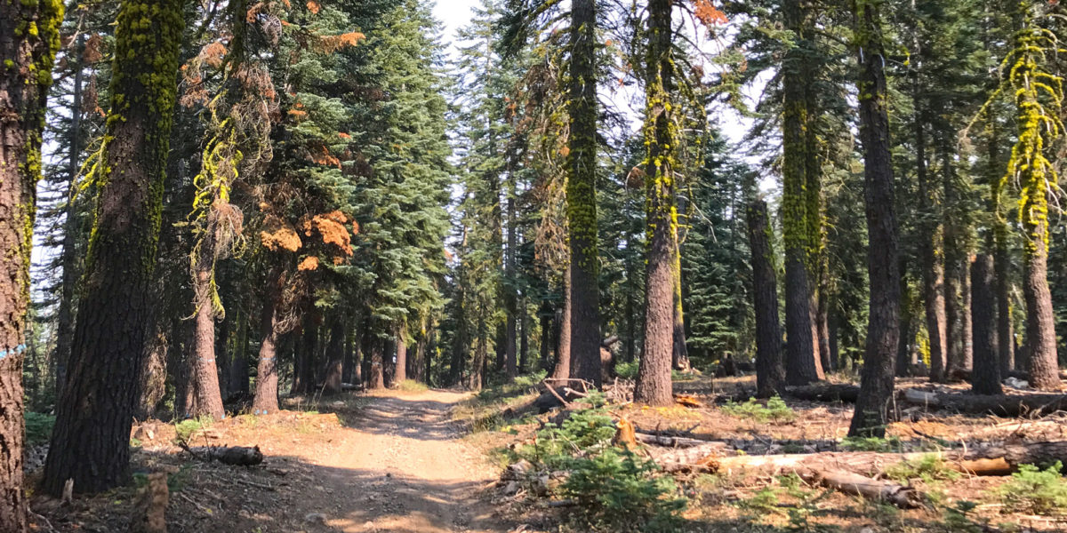
Starting out on the Forest Route
Taking a left (the only option) once off the highway, the route briefly climbs to the west. Then there’s a sharp right turn onto the dirt road. This is where things started getting dicey. I had heard from a previous activator that he was able to do this as a drive-up in his 2WD pickup truck. I’m thinking the road must have been in better shape when he did it. There were massive water ruts in the road, combined with pretty big rocks. With careful negotiation of these obstacles, I was able to proceed. Once in a while, I’d hear a light clunk or scrape underneath the vehicle, and other times I’d have to squeeze up against bushes on the side of the road in order to stay out of the ruts.

One of the nicer rough sections
Not all of the road was bad. It would occasionally smooth out. But after going through several tough spots, a little under a mile in, I finally decided to park the Pilot off to the side and hike the rest of the way. As it turned out, the road mostly wasn’t too bad from that point on, but I had no way of knowing, and I didn’t want to do anything to damage my wife’s daily driver.

Time to hike!
The hike
The road gently climbs the whole way to this summit. It would have been an easy hike, but at this point, I needed to really hustle to make sure we’d be back at a reasonable time. With pretty warm temperatures and smoke in the air (from various forest fires throughout California), it was a fast and sweaty hike.
The hike is pretty simple: keep going up. There weren’t any junctions until getting to a green gate. This is an undesignated road that runs along Bailey Ridge and takes you to the summit. As far as I could tell, the gate is there to keep cattle in/out, since there were no locks, signs or anything else. It just swings open. Even if the gate were to be locked at some point, I believe the section of road just outside the gate is within the activation zone.

The summit is about 200 yards past this gate
We went through the gate and stopped at what seemed to be the high point. My altimeter agreed this was the spot, too. There are lots of tall trees perfect for throwing antenna wires.
Operation
I quickly got my antenna wire out, threw it up into the tree and and got it stuck. Oops! For a while, I tried to get the weighted end to drop, by whipping the whole thing up and lessening the weight where the rope goes over the tree—no luck. Fortunately, I was able to just pull the whole thing back over the tree branch and re-throw. This time, it worked. I got the far end up about 35-40 feet and sloped it to the east. I propped the close side up on a stick about 4-5 feet off the ground and ran the remainder to my radio.
Normally, this is where I’d post pictures of my setup. But I totally forgot! I don’t know if it was the fact that my friend had his drone with him, or that I was in a hurry, but I just totally forgot to do my usual photo documentation.
Anyway, having gotten all set up, I was now ready to see if I could self-spot and make some contacts. My primary phone, on the T-Mobile network, didn’t have any service. However, my “dumb-phone”—a prepaid phone on the Verizon network—had a decent signal. Typing an SMS on a dumb-phone is a bit of an effort—especially when putting in summit designations—but I was able to get the appropriate text sent to a SOTA SMS gate and get myself spotted for 40 meters.
After a couple minutes of calling CQ, I started getting answers. I made 6 QSOs on 40 meters. I would normally switch over to 20 meters at this point, but really had a time constraint on getting back. Also, we had gotten a bit of cloud cover, making it an excellent time to hike, avoiding some of the sun’s heat.
All in all, a fun activation! Always a new adventure with each new summit.
Thanks to all the chasers!
Activation log
| Time | Call | Band | Mode |
| 21:37z | WA7SB | 7MHz | SSB |
| 21:40z | NS7P | 7MHz | SSB |
| 21:42z | K6HPX | 7MHz | SSB |
| 21:43z | W7KKM | 7MHz | SSB |
| 21:43z | WA6YPE | 7MHz | SSB |
| 21:44z | KD0YOB | 7MHz | SSB |