| Activation Date: 26 August 2017 | |
| Transport: Hike | Distance: 5.6 miles |
| Elev. gain: 850 feet | Time: 2 hours |
| Rig(s): FT-817, VX-2R | Band(s): 40m, 20m SSB |
| Antenna(s): End-fed half-wave, 12.5 inch flex whip | |
| Cell Service: Marginal/None (T-Mobile) | |
| Parking: Side of road, Highland Way and Buzzard Lagoon Rd | |
| Trailhead: Buzzard Lagoon Rd | |
| Fees/Permits: None | |
| Route: Buzzard Lagoon Rd, Aptos Creek Fire Rd | |
| Dogs: Not sure | Toilet: No |
Hot, hot, hot! Well, for the SF Bay Area, at least. I chose this as a relatively easy, nearby summit that I hadn’t done yet. And with the hot weather in Silicon Valley, I figured I might have a chance of some cool ocean air, by getting closer to the ocean. Not so. I had decided to bring my 8-year-old son on this hike, after asking him if he’d like to go (and if he’d be happy working the radio with me, or finding something else to do for 30+ minutes). He said he’d like to look at trees and bugs. OK! I also asked my 6-year-old son if he’d like to go but he wasn’t initially interested. Come the morning of the hike, he changed his mind and they both wanted to go!
For this trip, I packed my usual FT-817 kit, with my end-fed half-wave antenna. I think I brought along a CW paddle, but didn’t use it. I’m just not there yet. I also brought snacks, first aid kit, water, etc. My boys each had their own small backpacks with water and snacks. The super fun bonus item I brought this time around, was my hammock! This turned out to be a real winner—pretty much all the boys did while I operated, was hang out and swing in the hammock.
I’d heard from other trip reports that this was a very popular mountain biking spot—primarily the Soquel Demonstration Forest, which is either connected to, or part of Nisene Marks. I wasn’t concerned about this, since we’d be on fire road the whole time. We did end up seeing at least a few dozen riders—all of whom were exceedingly polite.
Getting there
Taking the Summit Road exit from Highway 17, I headed east until it turned into Highland Way and kept following that all the way to Buzzard Lagoon Road/Ormsby Cutoff. Highland Way turns into Eureka Canyon Road here. There’s a wide spot there, and room for several cars to park. The gate is open to Buzzard Lagoon Road, and in a high-clearance vehicle, I bet one could drive a good chunk of this hike. In my Passat, that’s not going to happen—maybe next year I’ll take the Honda Pilot.

Looking back at where I parked—start of trail behind me
Of note is that well before I got here, I lost cell reception (T-Mobile), so if you’re going to do any cell communication, do it before Summit Road turns into Highland Way.
The hike
I don’t know the exact temperature when we started out, but it was hot. Possibly 86F/30C, and no wind to speak of. My boys aren’t normally the speediest hikers, but the heat really slowed them down. What would normally be a pretty quick hike turned into a bit of a slog. But I tried to steer attention away from the heat and onto the interesting flora and fauna on the way.

Starting up Buzzard Lagoon Road
The dirt road starts out climbing gently, and pretty much keeps that up the entire time. A little way up Buzzard Lagoon Road, we came across an interesting gate to someone’s property—it had welded spikes facing out! Needless to say, we didn’t try going in there.

Spiky gate – pretty cool!
About a half mile in, Buzzard Lagoon Road enters The Forest of Nisene Marks State Park (that’s a mouthful!). There’s a sign saying no camping, fires, etc. I didn’t see anything here that said dogs aren’t allowed. I know they’re not allowed in other parts of the park, but maybe in this remote region of it, nobody cares. I didn’t have my dog with me (too hot), but I try to keep an eye out for these things anyway. There’s a gate at this entrance, but it doesn’t look like it’s getting closed anytime soon.

Entrance to the State Park
A little under a mile in, Buzzard Lagoon Road meets up with Aptos Creek Fire Road. Here, you’ll want to make sure you turn right (uphill) so you don’t head down to the ocean (that’s a long hike).

Junction with Aptos Creek Fire Road (turn right)
Most of the hike is nicely shaded—a very welcome thing for a day like this one.

On Aptos Creek Fire Road
Around 1.5 miles in, the trail starts getting out of the shade. And there’s another gate. This one looks like it might get closed every now and then, blocking vehicle traffic, but not hikers or mountain bikes.

Out in the sun!
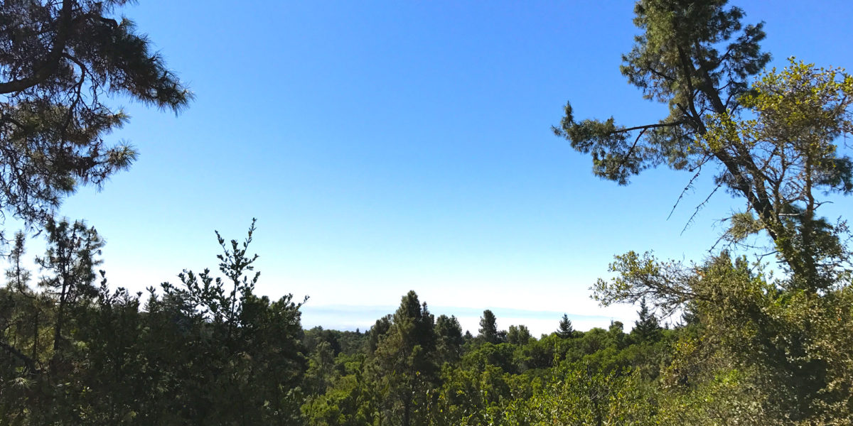
Getting out into the sun comes along with the only view on the whole hike—looking out towards Monterey Bay.

Clouds over Monterey Bay
Before long, you’re back in the shade of the trees, and near the summit.

Approaching the activation zone
I think it may be a relatively new trail, in the activation zone, that leads right up to the actual summit. I forgot to get a picture of it, but you’ll see it on your right as you round the bend. Since it was hot, my boys were more than ready to stop once we got to this area. Since we were well within the activation zone, I didn’t bother to go to the actual summit, where we’d simply see more trees. Just off the summit trail, there was an excellent spot for setting up the hammock and plentiful options for throwing an antenna up into the trees. I got the hammock set up for the boys, and proceeded to set everything else up.

The boys were happy to be taking a break!
Operation
I had my arborist’s throwing weight with me and I was able to get the wire up about 30-35 feet at the far end. I used my 7-meter squid pole propped in a nearer tree to keep the wire about 10 feet off the ground, which then sloped down to my radio.

Highlighted antenna wire path
Since I didn’t have cell reception here, I set up my MobilinkD Bluetooth TNC and Baofeng radio, hooked up to the roll-up J-pole antenna hung from a nearby tree. I got the beacon going on that while I found a clear frequency on 40 meters. Once I found a clear frequency and checked to see if it was in use a few times, I fired off a APRS message to spot myself. I wasn’t entirely sure if it would work, since I’ve had it fail on other summits. In this case, however, it worked quite nicely. The message went out and I had an “ack” back within seconds. Time to make some contacts!

The operating position
Normally, I bring a little pad to sit on while operating. I had forgotten it, so I sat in the leaves with the bugs and spiders and enjoyed the shade. I got a few contacts on 40 meters, before moving on to 20 meters. I spotted myself on 20 meters, but didn’t get answers to my CQ’s many minutes. Rather than continue with that, I decided to tune around. Knowing the Kansas QSO Party was happening, I figured I would be able to find some stations running. Sure enough, I found a couple of stations and made the exchange with them.
Needing to wrap it up and head home before it got even hotter, I ended off at 5 Q’s. The whole time I had been doing this, my boys were happily playing on the hammock, taking turns swinging each other and various other bits of fun.
The hike back was definitely hot, but being mostly downhill, went a lot faster than the hike up. Next time it’s hot like this, though, I’ll definitely bring more water!
Activation log
| Time | Call | Band | Mode |
| 18:40z | N6KZ | 7MHz | SSB |
| 18:43z | NS7P | 7MHz | SSB |
| 18:49z | K6HPX | 7MHz | SSB |
| 18:57z | W0N | 14MHz | SSB |
| 19:01z | W0S | 14MHz | SSB |