Quick Info:
| Activation Date: 20 June 2020 | |
| Transport: Hike | Distance: 1.5–11 miles |
| Elev. Gain: 1200–3400 feet | Time: 1.5–5 hours |
| Rig(s): MTR-3B | Bands: 40, 30, 20m CW, 2m FM |
| Antenna(s): Tri-band EFHW | Antenna Support: None |
| RF Noise: Low | Cell Service: Fair (T-Mobile) |
It’s good to get out and get some fresh air once in a while. Even if the air is a little thin! Having been invited by Adam K6ARK on a trip to the Eastern Sierra was something I just couldn’t turn down. The plan was to hike up from the Onion Valley trailhead and camp at a lake, and do a few summits while we’re up there. We ended up just doing this one, but a fun one it was!
Getting There
| Parking: Onion Valley Rd / Kearsarge Pass |
| Trailhead: Stevenson Mountain |
| Fees/Permits: Day Use: None. Overnight: Hard to get – quota system – $5/ea – reservations.gov |
| Route: Kearsarge Pass Trail, then summit direct |
| Dogs: Yes | Toilet: Yes |
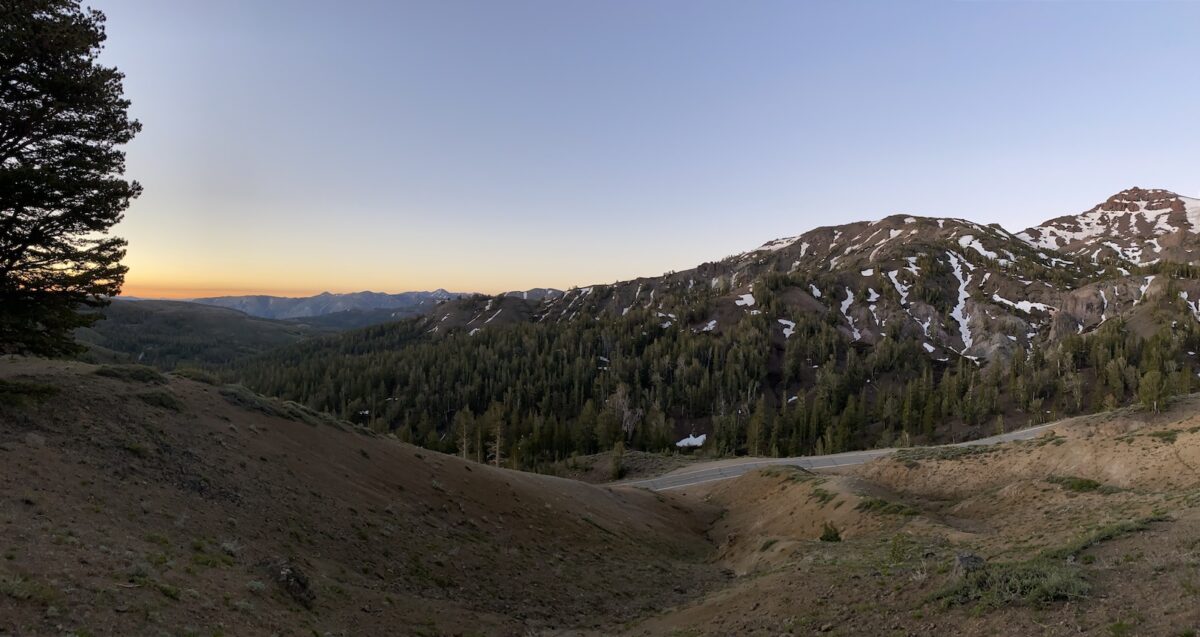
We were all coming from different places (and couldn’t go together anyway, due to “social distancing”). I drove over from the SF Bay Area, with Adam and others driving up from SoCal. Our trip was Friday thru Sunday, but I left Thursday night in order to get a head-start on the 7+ hour drive. I went via Sonora Pass and actually slept there, at ~9600 feet, in order to start acclimating to the altitude. I woke with a pretty strong headache – mission accomplished!
After enjoying a beautiful sunrise in the mountains, I hit the road again.
I stopped at an excellent spot for a coffee and breakfast sandwich, the “Latte Da Cafe” in Lee Vining. And I’d originally planned on stopping at Erick Schat’s Bakery in Bishop, but on Adam’s advice, I avoided that tourist destination and got myself some beyond-excellent sandwiches at Great Basin Bakery, just down the street.
Continuing south on Highway 395 (what a beautiful road!), I got to the town of Independence, turned right on Market Street, which shortly thereafter turns into Onion Valley Road. Following that all the way to the top, I made it to the parking area for the trailhead. And boy, it was full! I did manage to find a spot after a little bit of looking. I met up with Adam and crew, then we hiked to camp!
The Hike
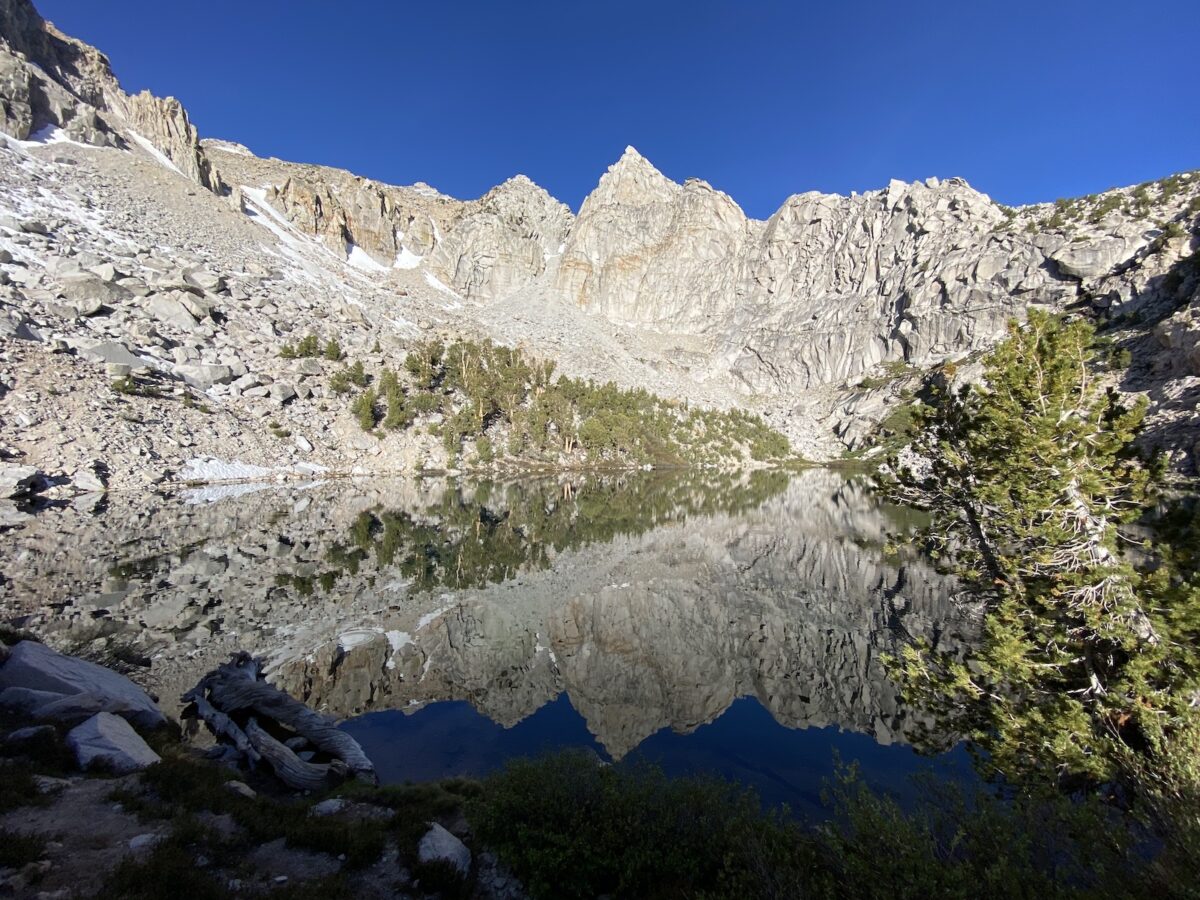
Since we were camping, we started our hike at the lake. If you’re doing this as a day trip, you’ve got a longer (11-ish miles) hike ahead of you. Ours ended up being around 4.5 miles or so.
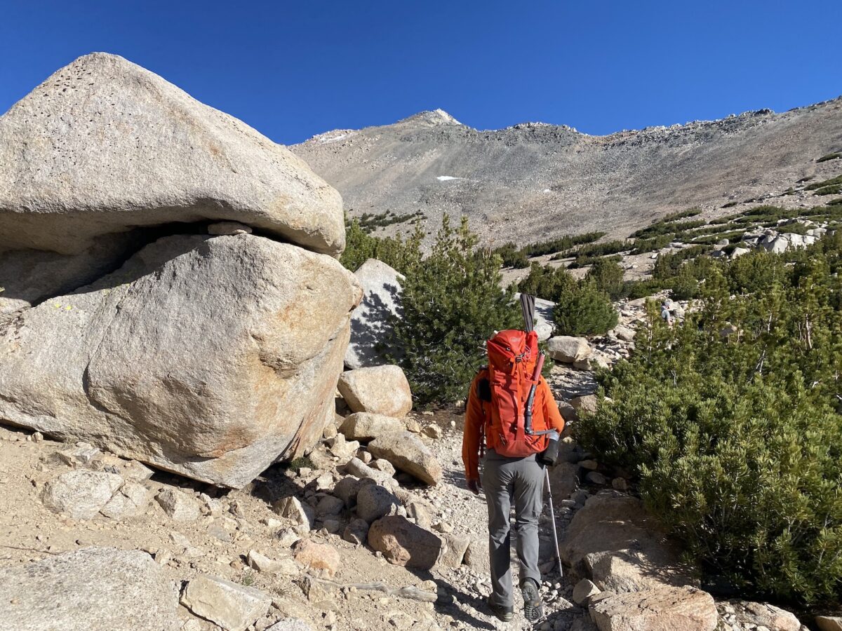
Starting out with a gentle scramble up to the Kearsarge Pass Trail, we could tell it was going to be a fine day. Our plan was to do Mount Gould, then see if we felt like going over to nearby Mount Rixford. After a short distance on the trail, our summit was in sight.
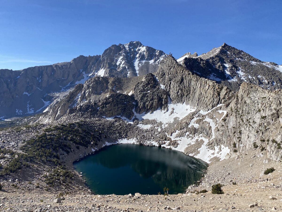
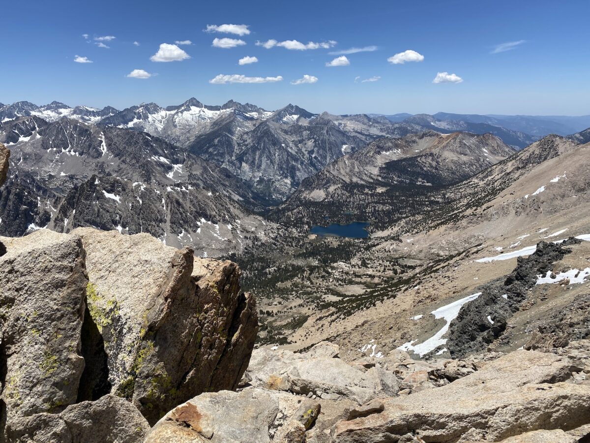
We were taking it pretty easy going up the trail, enjoying the scenery. I was definitely feeling the fact that we were over 11k feet. The scenery itself was absolutely breathtaking.
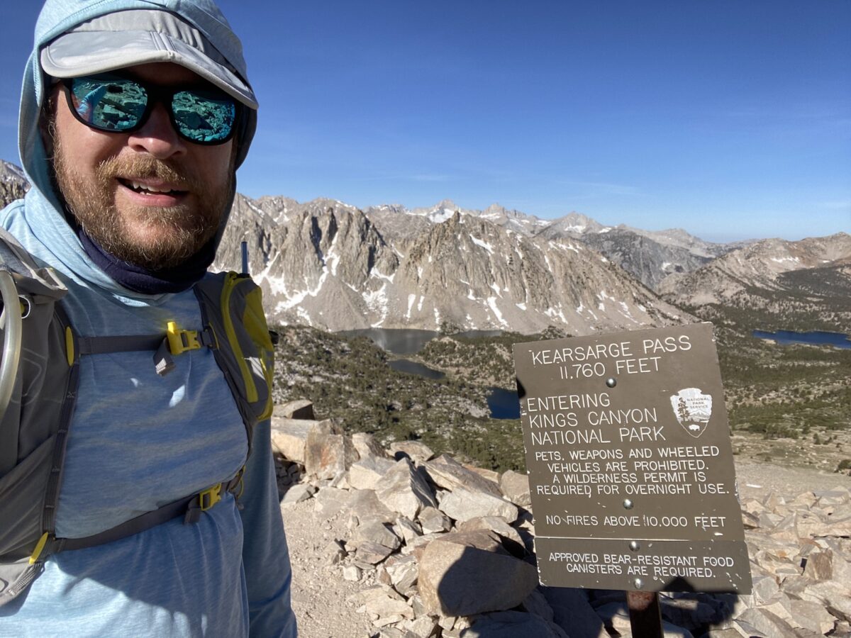
Before long, we arrived at Kearsarge Pass, where we took a sharp right and proceeded to head straight for the summit.
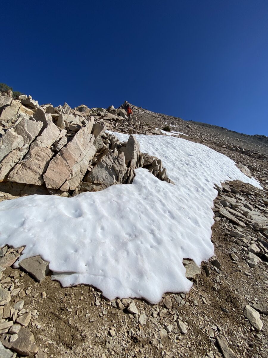
The terrain leading to the summit is pretty straightforward – a light class 2 climb up the ridge to the summit.
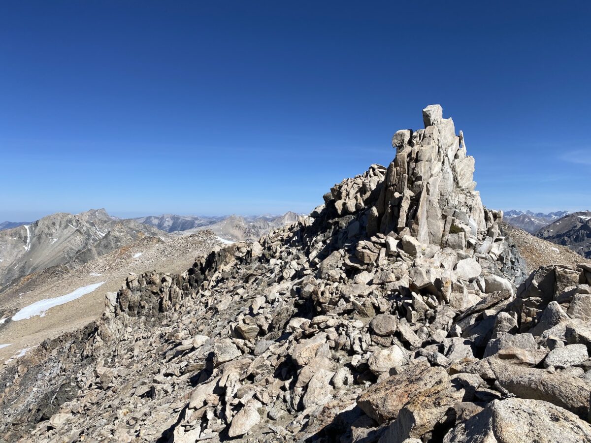
Nearing the top, the views really start to open up. I couldn’t resist turning around to soak in the views of the surrounding mountains and lakes.
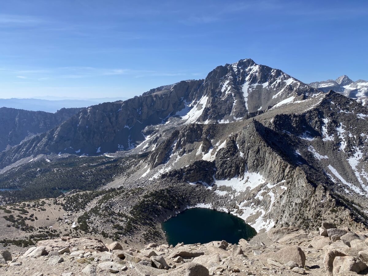
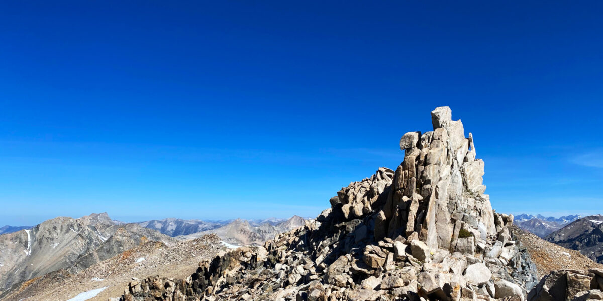
Arriving at the top, there’s a little bit of a (narrow) plateau.
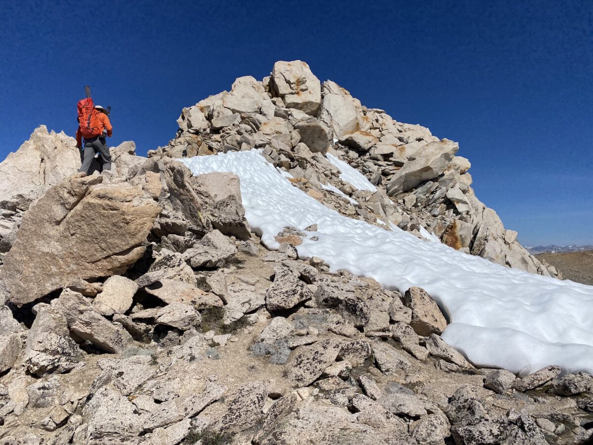
The actual summit block is just a little bit further, and requires a class 3–4 climb to the top. I wanted to go up there, but I decided to save it for later—just before we left.
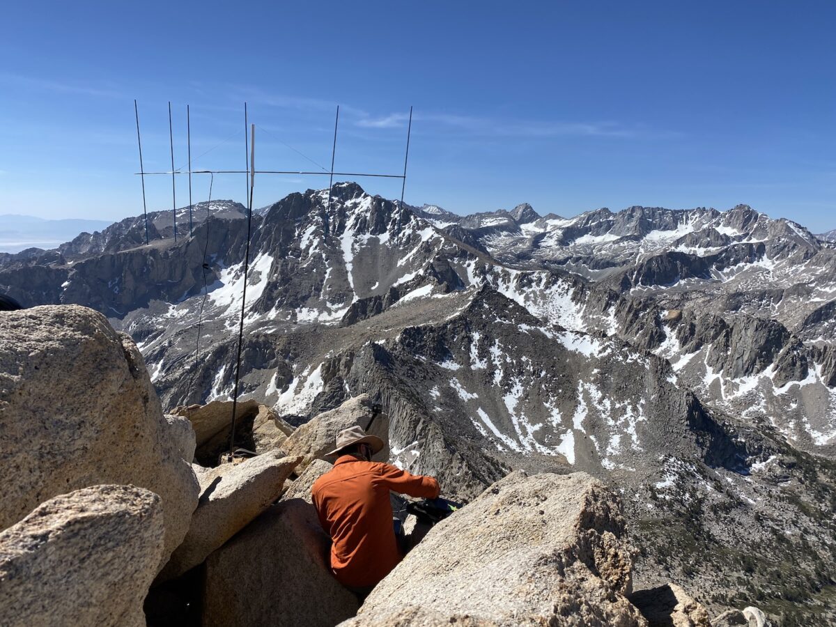
By this time, I’d gotten a good look at what the effort to get over to Mount Rixford would be. Adam and I discussed and agreed we’d probably just stay at Mount Gould longer, making it our only summit for the day. We took a moment to enjoy the views, then proceeded to set up our radio equipment!
Setup and Operation
Since we had another ham back at camp, Dennis KA6DUH, Adam and I both made contact with him on our HT’s as our first contact for the activation.
Adam and I discussed our operating plans on the way up, and having arrived, finalized our plans. I’d be setting up and operating on HF first, with Adam setting up his home-brew beam antenna and getting some long-range VHF contacts!
I set up my little MTR-3B radio, with my trapped EFHW antenna, and decided I’d focus mostly on making summit-to-summit (S2S) contacts. I made a couple of those, then put out a spot on SOTAWatch to make some regular contacts. After those dried up, I went back to chasing S2S and got a bunch more. I think I ended up getting a record number of S2S contacts (for me) at 8 total summit-to-summit contacts.
By then, Adam had moved on to HF (and he moved away from my position on the summit so we wouldn’t have interference). I got another contact on 2 meters FM, then put out another SOTA spot – this time for 30 meters. I made several more contacts there.
Once we were all wrapped up with our radio operation, we went to go climb the actual summit block. Here’s a video of that fun little climb, courtesy of Adam K6ARK:
Activation Log
| Time | Callsign | Band | Mode | Notes |
|---|---|---|---|---|
| 16:54 | KA6DUH | 2m | FM | |
| 17:21 | N1CLC | 20m | CW | S2S W6/CT-010 |
| 17:32 | KE7BGM | 40m | CW | S2S W7A/CS-018 |
| 17:47 | KF7WI | 20m | CW | |
| 17:52 | N9KW | 20m | CW | |
| 17:54 | WU7H | 20m | CW | |
| 17:58 | VE7JH | 20m | CW | |
| 18:00 | W5ODS | 20m | CW | |
| 18:01 | W0MNA | 20m | CW | |
| 18:04 | W0ERI | 20m | CW | |
| 18:07 | VE7HI | 20m | CW | |
| 18:16 | K5DEZ | 20m | CW | S2S W5N/PW-013 |
| 18:24 | NM5S | 30m | CW | S2S W5N/PW-013 |
| 18:54 | N7CW | 20m | CW | S2S W7A/AW-006 |
| 18:58 | WY7N | 40m | CW | S2S W7U/TO-008 |
| 19:07 | AE7AP | 20m | CW | S2S W7M/CL-030 |
| 19:09 | WC6J | 20m | CW | S2S W6/NS-122 |
| 19:14 | N6AZY | 2m | FM | |
| 19:25 | W7USA | 30m | CW | |
| 19:26 | N9KW | 30m | CW | |
| 19:27 | VE7EA | 30m | CW | |
| 19:30 | K7SO | 30m | CW |