| Activation Date: 7 January 2018 | |
| Transport: Hike | Distance: 7.5 miles |
| Elev. gain: 1,225 feet | Time: 2.5 hours |
| Rig(s): LNR Precision MTR-3B, Radioddity GD-77 | Band(s): 30, 20, 40m CW, 2m FM |
| Antenna(s): End-fed half-wave (HF), 12-inch whip (VHF/UHF) | |
| Cell Service: Good (T-Mobile) | |
| Parking: Bear Ranch Parking Lot | |
| Trailhead: Bear Ranch Parking Lot | |
| Fees/Permits: None for this entrance | |
| Route: Willow Springs, Harvey Bear, and Ed Willson trails | |
| Dogs: Yes | Toilet: Yes |
My first hike and summit activation of the year! It’s just a little one-point summit, but it’s one of my favorites. It’s easy to get to, and it’s a beautiful hike up to a pretty secluded spot.
I also wanted to bring my dog, Tashi, on a good hike. We recently had a puppy fall into our laps, so I wanted to give her some special time doing one of her favorite activities.
Getting There
Just drive to the spot listed in the link above. It’s free and there’s plenty of space. I arrived right around sunrise. I’d driven through some pretty thick fog to get there, but it was an otherwise uneventful drive.

Arriving at the park
The Hike
I won’t go into the detailed turn-by-turn. I covered it pretty well in my original post. Notably though, the place looks quite a bit different with the change of seasons.

Hiking into the sunrise
Last time I did this summit, I was hiking through fog. This time, I got to see a lot more.

I had to drive through that fog down in the valley

Another beautiful view of the sunrise
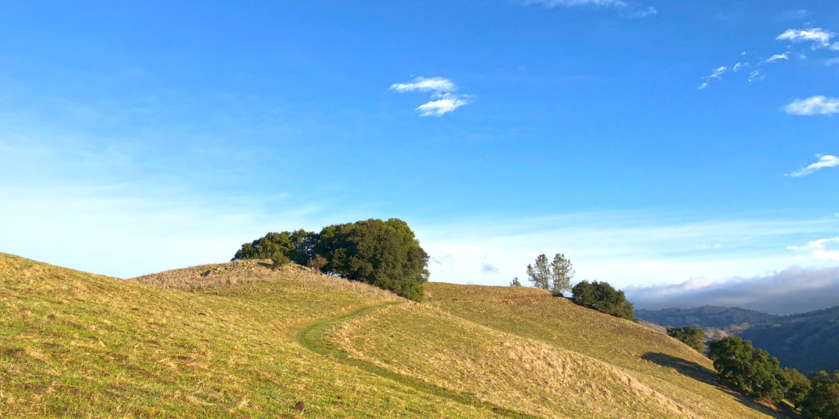
The hike is a steady, fairly gentle climb along an old ranch road. At a steady pace, it isn’t too long before the summit comes into sight.

Looking toward the summit (left of center)
Turning onto the final trail leading to the summit, I could see the summit straight ahead. I knew the trail did a bit more twisting and turning before arriving there. The grass was quite short this time of year, so I decided to leave the trail and head straight to the summit.

Heading straight for the summit
This seemed like a great spot to get a nice picture of my dog.

Tashi
Finally, up and over the ridge, I arrived at the summit. Mind you, it’s not the actual summit, which is on the other side of a fence on private property. But it’s about the same elevation, and it’s right next to the actual summit.

Arriving at the summit
Before finding a spot to set up, I enjoyed the view for a bit, snapping a picture of the Coyote Reservoir below.

Coyote Reservoir from above
One thing I did on this hike, that I also did on my last one, was to use APRS to keep potential chasers apprised of my progress. But amazingly, not a single packet made it to the internet! I’m not even sure if any were received by digipeaters. Looking on the map, I noted that there weren’t any digipeaters or iGates near me, but with the elevation, I should have been able to get at least a few packets out to far-away stations. I’ll have to look into what might be going on there.
Setup and Operation
I got my antenna really high! Last time I activated this summit, I didn’t get my wire very high, and I was inside a grove of trees on the summit. I considered that for my operating position this time around, but there’s a very tall tree just off the summit that seemed it could be better. The tree is easily over 70 feet tall. Its base is about 20-30 feet below the trail on a very steep slope, so getting the wire up would consist of a good hard throw. I honestly wasn’t sure I could accurately land it. The first try didn’t even come close to making it. Fortunately, I’d remembered to stand on the near end of the wire. It didn’t get away. I brought it all back and tried again. Nailed it!

Antenna wire in position and ready for operation
I had the antenna set up for operation on 30 meters to start out. I had good cell service, so I looked for any SOTA spots to see if I could get a summit-to-summit contact or three. I didn’t see any on 30 meters, so I found a clear frequency and started calling CQ. Within a couple of minutes, I was making contacts.
Once I stopped making contacts on 30 meters, I pulled the wire toward me and switched it to the 40/20 meter configuration. Switching to 20 meters, I called CQ and had the contacts roll in. I got plenty there, including two DX – Spain and New Zealand! I really appreciate those stations putting in the effort and heavy lifting to make contact with me, and I’m really glad I had my antenna up high.
Switching to 40 meters after a short break, I made several more contacts, including two summit-to-summit contacts. One of those was a very persistent N7JH on a summit in Arizona. I somehow missed that he was a S2S station when we first exchanged reports, and he kept trying to convey the S2S info. We finally made the full exchange of signal reports and SOTA references to get each other in the log.
With HF done, I put out a spot for 2 meters and got one contact there, while I packed up the station. What a great and pleasant activation!
Activation Log
| Time | Call | Band | Mode |
| 16:59z | W7GA | 10MHz | CW |
| 17:02z | VE7HI | 10MHz | CW |
| 17:03z | AB6SO | 10MHz | CW |
| 17:05z | W0MNA | 10MHz | CW |
| 17:06z | KT5X | 10MHz | CW |
| 17:08z | KR7RK | 10MHz | CW |
| 17:09z | W0ERI | 10MHz | CW |
| 17:10z | N6PKT | 10MHz | CW |
| 17:11z | NU7A | 10MHz | CW |
| 17:22z | VE2JCU | 14MHz | CW |
| 17:24z | N4EX | 14MHz | CW |
| 17:25z | WA2USA | 14MHz | CW |
| 17:26z | W5GAI | 14MHz | CW |
| 17:28z | W5ODS | 14MHz | CW |
| 17:29z | K4QS | 14MHz | CW |
| 17:30z | EA2LU | 14MHz | CW |
| 17:33z | ZL1BYZ | 14MHz | CW |
| 17:35z | KG3W | 14MHz | CW |
| 17:40z | KB7HH | 7MHz | CW |
| 17:44z | NW7E | 7MHz | CW |
| 17:45z | NG6R | 7MHz | CW |
| 17:46z | NS7P | 7MHz | CW |
| 17:47z | WA7JTM | 7MHz | CW |
| 17:48z | NQ7R | 7MHz | CW |
| 17:50z | K6EL | 7MHz | CW |
| 17:50z | W7RV | 7MHz | CW |
| 17:51z | KX6A | 7MHz | CW |
| 17:52z | N7YY | 7MHz | CW |
| 17:53z | KE7BGM | 7MHz | CW |
| 17:59z | K7OBX | 7MHz | CW |
| 18:15z | N7JH | 7MHz | CW |
| 18:22z | KI6KD | 144MHz | FM |