| Activation Date: 2 July 2017 | |
| Transport: Run | Distance: 7.5 miles |
| Elev. gain: 1,270ft | Time: 1.5 hours |
| Rig(s): FT-817, VX-2R | Band(s): 40m, 20m SSB, 2m FM |
| Antenna(s): End-fed half-wave, 12.5inch whip | |
| Cell Service: Solid (T-Mobile) | |
| Parking: Free, dirt parking lot | |
| Trailhead: Bear Ranch Parking Lot | |
| Fees/Permits: None for this entrance | |
| Route: Willow Springs, Harvey Bear, and Ed Willson trails | |
| Dogs: Yes | Toilet: Yes, trailhead/parking lot |
Yes, even early July can be cold. This is what I found out, doing this early-morning trail run in San Martin (between the cities of Morgan Hill and Gilroy). When conditions are right, a nice marine layer moves in to this part of the valley, bringing plenty of moisture and cool air up from the south. The conditions were right this morning! In this case, the marine layer was sitting at around 500 feet above sea level, which meant I’d be ascending into the clouds to activate W6/NC-367 (unnamed peak 1502).
Entering Coyote Lake Harvey Bear Ranch County Park (wow, that’s a long name!) from this side made my drive quite a bit shorter, and there’s apparently no vehicle entry fee for this entrance. That’s a win-win scenario!

The parking lot was empty when I started
Parking was easy enough — arriving around 6am, I was the only one there. Getting out of the car, I realized it would likely stay chilly for a while, and had a fleeting thought of stuffing my windbreaker somewhere in my kit, but decided to leave it. I later wished I hadn’t.

Trailhead
Starting out was easy enough — this seemed to be a pretty popular place, so the trailhead is quite obvious. Immediately after the trailhead, take a right, unless you want to follow a paved square-shaped loop around this part of the park and end up right back where you started.

Start of Willow Springs Trail
Not far after you’ve started out on Willow Springs trail — maybe a quarter mile, you’ll come to Harvey Bear trail. It’s a very obvious spot, where you’ll turn left.

Start of Harvey Bear trail
Views of the valley below immediately start to open up. In my case, this was short-lived, since I was ascending into the clouds.

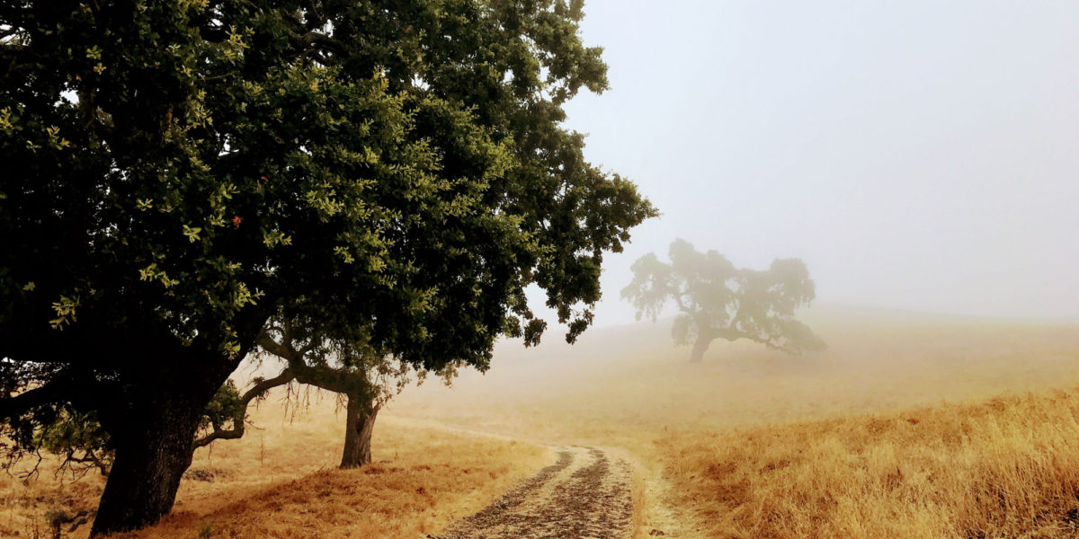
Amongst all the grass, you’ll see oaks here and there. Sometimes right next to, or over the trail.

Oak trees along the trail
You’ll want to make sure you stay on Harvey Bear trail—there are a couple of trails that meet up with it along the way. They’re signed so that you know you’re still on Harvey Bear trail.
One of the intersections where you’ll just go straight
One thing you’ll want to keep in mind if you’re alone or one of the only people on the trail, among the usual safety considerations: cows. As mentioned in other posts, this mountain range consists of a lot of cattle-grazing land (even the parts that are state parks). During this time of year, you’ll see calves as well, which means you need to be careful and pay attention to your position in relation to cows and their calves. On this trip, I had my dog with me, which makes the cows even more on-edge.

We had to *carefully* pass these cows
At around 2.5 miles in, you’ll come to the final turn—onto the Ed Willson trail. The only signage at this junction is a signpost pointing out the continuation of the Harvey Bear trail. You’ll make a left here.

Junction for the Ed Willson trail
The trail winds around near the summit before doing a steep descent between ridges. You’ll want to stop before this. The summit proper is on the other side of a barbed-wire fence, but this section of the trail is thoroughly within its activation zone.

Actual summit somewhere in that fog, I think!
As I was ascending into the clouds, with my running shorts and t-shirt, I knew I was going to be cold after stopping to play radio. I accepted this, since it wasn’t dangerously cold. I ended up finding some oak trees into which I could throw my end-fed wire and act as a wind break. They did well on both counts, but the clouds blowing through them caused quite a bit of condensed moisture to fall on me while operating!
Before I got fully set up, I called out on 146.52 FM, with my little Yaesu VX-2R handie-talkie. It only puts out about 1.5 watts, but with a 12.5 inch whip, I find this is often enough for line of sight contacts 10-30 miles away, and sometimes more. I got two contacts there by the time I got my HF setup going.

My FT-817 doesn’t mind getting a little bit wet
I’m still learning ways to set up the end-fed half-wave antenna. This was only the second time I was attempting to set it up in a tree. I used my half-empty water bottle tied to the end of the paracord attached to my antenna wire, and managed to get it up over a branch 20-25 feet on my first try. However, I soon discovered that wet trees and paracord tend to create some friction. But with some shaking and gentle prodding, I got it into position. Winning! I set it up as a sloper, facing E-NE as far as I could tell. I forgot to check my compass. Anyway, it worked. I got nice clear contacts on 40m. The contacts didn’t come so easily on 20m, where I got only one. I think the antenna wasn’t at full performance being amongst the wet trees, and also, 20m just isn’t very “awake” at 7:30am. Nonetheless, with the VHF contacts and the 40m contacts, I had 5 QSOs. I consider this to be my personal minimum, unless things are really rough.

End-fed wire going up to a distant tree
Once got cold enough to start shivering (which could be heard when I called CQ!), I decided it was time to pack things up and get moving again. It took me about 5-10 minutes to get everything wound up and packed. It’s hard to do this while shivering, but made all the faster by my need to finish up and get warm. Starting the run back down, my body warmed itself pretty quickly. Plus, I found once I got out from under the trees that more of the sun was coming through the previously thick clouds.

Still on the Ed Willson trail, on the way down
This route was really great for trail running, so I was able to maintain a pretty good speed on the way down, slowed only by my aging dog, who had to work to keep up. It wasn’t long before I started seeing the parking area.

Parking area from above
Back at the parking lot, I found that I was definitely no longer the only one!

Parking lot, from adjoining picnic area
Every time I go do a SOTA activation, it’s a learning experience in different ways. This time, I learned more about how to set up my antenna (which I do almost every time!). And I learned that if I think I might need a windbreaker, bring it!
It was fun having my dog along for this trip, though I can definitely tell she’s getting old—she was lagging quite a bit on the way down. Still, we both had fun.

Tashi
Activation Log:
| Time | Call | Band | Mode |
| 14:17z | WB6KHP | 144MHz | FM |
| 14:37z | KC6WTF | 144MHz | FM |
| 14:42z | KX6A | 7MHz | SSB |
| 14:46z | K6HPX | 7MHz | SSB |
| 14:53z | W0MNA | 14MHz | SSB |